.JPG)

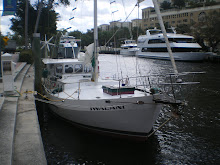
Iwalani Current position
Tuesday 03-31-09, Lat: 23* 31.2N, Long: 075* 45.7 W Elizabeth Harbour, Exuma Island. Winds SE 10-15 kts; mostly clear skies, good visibility.
Thursday, March 26, 2009, moored and anchored Little Farmers Cay, Exuma
0730: We awake to constant winds out of the East at 20-25 kts, and
make the easy decision to stay another night at Little Farmers
Cay. After updating our blog ashore, we walk the 1.5 mile island,
chat with a few locals, buy some limes (2 for $1), decline some
local pakalolo offerings, and do a few routine maintenance chores
on Iwalani. It's an easy relaxing day, thoroughly enjoyed during
this transit south. We had previously referred to our inflatable
as "Alaka'i", but in honor of my good friend Genie - char siu duck
- Kincaid, we have opted to christen her "Opihi", the rare yellow
one, stuck fastly behind Iwalani.
1700: Off to the hermit crab races ashore at Ocean Cabin
Restaurant, in the middle of town. By the way, town consists of
two buildings. Ocean Cabin Restaurant, and the littlest bar in
the Bahamas, standing room only, maximum capacity - five. We
arrive just in time for the final race and place our $1.00 bet on
#4 for 50% win, 25% place, 25% show. #4 comes out strong and
never lets up his lead, finishing first without a doubt. We win
$2.50 and end up paying $40.00 for drinks and one entree.
2000: We pay our bill and say our goodbyes at Ocean Cabin
Restaurant and head back to Iwalani. We've had great time meeting
new cruising buddies, but need to focus on our journey south.
Restaurant and head back to Iwalani. We've had great time meeting
new cruising buddies, but need to focus on our journey south.
Friday, March 27, 2009 Lat: 23* 57.4N, Long: 076* 18.9W, winds S
10-15 kts, COG: 203, partly cloudy skies, good visibility
10-15 kts, COG: 203, partly cloudy skies, good visibility
0830: Anchor up, release mooring, depart Little Farmers Cay towards
Georgetown, Great Exuma Island with good water at a high tide.
Georgetown, Great Exuma Island with good water at a high tide.
1145: Winding our way south, encountering extremely shallow
waters, scrapping bottom at 3.4 feet. Weaving through the East
and West Pimblicos, we had to "Thread the needle" on more than two
occassions, barely making passage. At times, we left a white
plumb of sand billowing in the water behind us, telltale signs of
bottoming out. It's no wonder we don't see another sailboat during this passage.
1330: Our passage through Norman's Pond Cay, Leaf Cay and the
northern point of Lee Stocking Island and Adderly Cut is like
traveling through the Bermuda triangle. Current is raging, tide's
ripping out and we slow to 2.7 kts. As we parallel the western
shore of Lee Stocking Island, we once again encounter shallow
depths of less than 3 feet and touch bottom.
northern point of Lee Stocking Island and Adderly Cut is like
traveling through the Bermuda triangle. Current is raging, tide's
ripping out and we slow to 2.7 kts. As we parallel the western
shore of Lee Stocking Island, we once again encounter shallow
depths of less than 3 feet and touch bottom.
1430: Having quite enough of the shallows for one day, we shortly
retrace our steps and head back to Williams Bay Anchorage off Lee
Stocking Island.
retrace our steps and head back to Williams Bay Anchorage off Lee
Stocking Island.
1500: Drop two anchors, Williams Bay Anchorage, Lee Stocking
Island, Exumas. Lat: 23* 45.6N, Long: 076* 05.2W in 5 feet of
water. There is one other catamaran, Alexander Glyn, anchored in
this small bay. Wine glass in hand, I am thankful to be with Chris
on this sometimes nerve racking but memorable journey. We are
truly blessed to be able to live our dream.
Island, Exumas. Lat: 23* 45.6N, Long: 076* 05.2W in 5 feet of
water. There is one other catamaran, Alexander Glyn, anchored in
this small bay. Wine glass in hand, I am thankful to be with Chris
on this sometimes nerve racking but memorable journey. We are
truly blessed to be able to live our dream.
1830: After going ashore and hiking the short hill to view the
Sound, we head back to Iwalani and plan the next days' travel.
Sound, we head back to Iwalani and plan the next days' travel.
1930: A frontal system is forecasted for tomorrow through
Saturday, with SW winds at 30 kts. It just may be our window to
exit out into the Sound to Georgetown, where we can find safe
harbour. But Capt Chris needs to make multiple contingency plans
for every leg of our trip, in the event the weather fouls and our
underpowered vessal cannot handle the "in-your-face" winds and
current. P.S. - our anchor dragging episodes are based on the fact that Iwalani is a steel hull vessal weighting 30,000+ pounds, in comparison to the majority of other
fiberglass vessals weighing +-8,000 pounds, attempting to anchor
in sand bottom. Can't wait to be in the Hawaii and the south
pacific, reef and rock bottom.
Saturday, March 28, 2009, Williams Bay Anchorage, Lee Stocking
Island, Exumas
Island, Exumas
0730: We meet our cruising neighbors on the beach, Eric and
Allison from CA, traveling with their two young children and her
parents. Sailing from Florida in their brand new Catamaran
Alexander Glyn, they encountered roaring ocean swells of 10-15'
with seas building, mom orders everyone to their bunks, then literally "surfed" their Cat into Rat Cay Cut. That must have been a hair raising experience for all
aboard, as the Cut is just wide enough to accommodate ONE BOAT in
CALM waters. Anchored since Monday, March 23, 2009, they've been
waiting for condusive conditions to head back out into the Sound
and on towards Georgetown, Great Exuma Island. Great family with a whooping sense of humor. After climbing the small hill to take a peek at the ocean conditions, Capt Chris
decides to stay put for the day. Weather reports forecasted an
approaching frontal system today with SSW winds at 20-30 kts.
Behind the front tomorrow, WNW 20-25 kts, diminishing on Monday.
Good decision as our protected spot recieved 30 kts gusts later in
the day.
1000: Chris and I put out a second anchor then putter around in
Opihi, searching for conch for fish bait. None to be found, just
one lonely clam. It'll have to do as our neighbors caught a nice
sized snapper with bacon! Water is mostly clear, the surface
winds whipping up some sand off the bottom, creating limited
visibility. The bottom consists of grass and fine sand, built up
in conical mounds. There are some holes where critters must live,
but are in hiding. Chris ties a line to Opihi and I try my hand
at maneuvering an outboard motor. Dragging Chris behind in the
water, I end up going in circles. Exasperated, Chris climbs in,
tells me I'm a terrible driver :-), and dumps me in the water,
dragging me along like bait off a sport fishing boat. I hope I
don't encounter any predators. We had a blast.
Sunday, March 29, 2009 Lat: 23* 44.4N, Long: 076* 03.8W, winds SE
10-15 kts, COG: 133, speed 4.8 kts.
10-15 kts, COG: 133, speed 4.8 kts.
0930: Anchors up, depart Williams Bay Anchorage, Lee Stocking
Island, heading to Georgetown, Exuma Island. After looking at the
Sound, Chris decides that although not perfect, it's good enough
to get moving. Eric and Allison decide to make the move too, and
we officially have a traveling partner. It's only 23 miles to
Georgetown but at 4 kts, it'll take us around 5 hours. As soon as
we exit the Banks and out to the Sound, the Cat takes off like a
race horse at 7-8 kts, arriving in Georgetown in 2.5 hours. Bye
bye traveling partner. See you in Georgetown. But we don't mind.
Good ole "hula hips" Iwalani handles like a charm. Didn't catch a
fish, couldn't sail, but the autopilot worked for 3 hours!
1530: Drop anchor, Stocking Island Anchorage, Georgetown, Exuma.
Lat: 23* 31.2N, Long: 075* 45.7 W, partly cloudy skies, good
visibility. There's literally a sea of sailboats anchored here. Regatta
Party central. After doing Iwalani's rinse down ritual, we head
ashore and have some drinks with Eric & Allison.
Lat: 23* 31.2N, Long: 075* 45.7 W, partly cloudy skies, good
visibility. There's literally a sea of sailboats anchored here. Regatta
Party central. After doing Iwalani's rinse down ritual, we head
ashore and have some drinks with Eric & Allison.
Monday, March 29, 2009
0730: Coffee in hand, we witness the mass departure of sailboats
headed north with the forecasted good & calm seas. We anchor up and move
across the bay, then drop anchor at Elizabeth Harbour, Georgetown,
Exuma.
headed north with the forecasted good & calm seas. We anchor up and move
across the bay, then drop anchor at Elizabeth Harbour, Georgetown,
Exuma.
0900: With time getting short, we decide to stay at Georgetown
for a few days to wait for a FedEx package, and I will fly out
from here on 4/5/09 and head home. We learn that Georgetown is a
main meeting ground for crusiers in the Bahamas. Last month,
there were well over 300 boats anchored here! Every morning at 8am, there's Boater's Net on VHF 72. It's a chat session for all boaters in the area and they cover everything from business, to arts, arrivals, departures, and trading "stuff". Pretty interesting if you can get a word in edgewise. Busy channel.
1300: Jonesing for surf, Chris goes for a paddle on his longboard.
It's an odd sight, but he enjoys it nonetheless. Even with such
beautiful clear water, it's a rare sight to see anyone swimming.
It's an odd sight, but he enjoys it nonetheless. Even with such
beautiful clear water, it's a rare sight to see anyone swimming.